 01
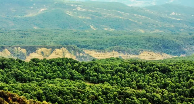
Arslanbob Walnut Forest
Arslanbob is one of the largest walnut forests in the world, on the slopes of the Babash-Ata range. Old trees, dappled light and village life.
Jalal-Abad region in the south-west is the greenest part of Kyrgyzstan: walnut forests, the Sary-Chelek biosphere reserve, deep river canyons, the turquoise Toktogul Reservoir along the Bishkek–Osh highway and the Saimaluu-Tash petroglyphs high in the Fergana Range.
On screen it can double for Mediterranean-looking forests and lakes, deep river canyons and turquoise reservoirs.
01Arslanbob is one of the largest walnut forests in the world, on the slopes of the Babash-Ata range. Old trees, dappled light and village life.
 02
Arslanbob Waterfall drops from a cliff above the village of Arslanbob, surrounded by walnut forest.
 03
Kara-Suu is a landslide-dammed lake at 2,022 m in the Toktogul district, inside the Alatay nature park: 6.5 km long, up to 2 km wide and about 90 m deep, with saturated blue water between the Takhtalyk and Ken-Kol ridges. From the town of Kara-Kul on the Bishkek-Osh highway it is about 30 km of rough 4x4 track with river fords, roughly 3 hours; no mobile signal, nearest villages 50 km away. Dry summer and early autumn only.
 04
Naryn Canyon is where the Naryn River cuts through steep rock walls in the south-west, with dramatic shapes and colours.
 05
Sary-Chelek is a mountain lake at 1,876 m, up to 244 m deep, inside a nature reserve founded in 1959 and now a UNESCO biosphere reserve, framed by steep slopes of spruce and walnut-fruit forest.
 06
Toktogul Reservoir is the largest reservoir in Kyrgyzstan, about 284 km² of turquoise water among bare mountains on the Bishkek–Osh highway.
 07
Chychkan Gorge carries the Bishkek–Osh highway along a mountain river with forested slopes and roadside herders' camps.
 08
Saimaluu-Tash is the largest rock-art site in Central Asia: more than 90,000 petroglyphs from the 3rd millennium BC to the 8th century AD on the slopes of the Fergana Range in the Toguz-Toro district, above 3,000 m. The site is under snow most of the year and accessible only in July and August.
UNESCO Tentative List: Saimaluu-Tash petroglyphs (2001) ↗| Location | By road | Drive time |
|---|---|---|
| Arslanbob Walnut Forest | ~529 km | ~8 h |
| Arslanbob Waterfall | ~529 km | ~8 h |
| Kara-Suu Lake | ~353 km | ~6 h |
| Naryn Canyon | ~381 km | ~6 h |
| Sary-Chelek | ~535 km | ~11 h |
| Toktogul Reservoir | ~349 km | ~6 h |
| Chychkan Gorge | ~252 km | ~4 h |
| Saimaluu-Tash | ~349 km | ~5 h |
Approximate figures by road from the centre of Bishkek, without stops; mountain roads and weather change the time. * to the nearest road, the location itself is reached on foot, by horse or by 4x4 track. We confirm the logistics for each project in the production plan.
We can run a location scout specifically for your script.
Updated: 2026-10-20